


CORPUS CHRISTI, Texas — With upper-level high pressure in place over the Lone Star State, our weather pattern is not forecast to change a whole lot for the week and right into the weekend.
Humidity levels are healthy though on the heels of a southerly to southeasterly wind coming in off the Gulf of Mexico. That means our heat index values each afternoon will shoot up past 100 easily. In fact, many of our inland communities will see these values max out around 110-117 as we head towards the end of the week.
If you will be outdoors for a prolonged period of time, be sure to take lots of water with you and seek the shaded spots frequently. The suns rays will be brutal in the afternoon, and it will not take much to experience heat stroke or heat exhaustion. Air-conditioned places will be best to beat the heat. Also, be sure to check on family and friends to be sure they are finding ways to stay cool. Finally, be sure your outdoor pets have access to shade and cool water.
The big “dome” of high pressure will become dominant over the latter part of the week and weekend and will promote lots of sunshine and sweltering heat as we see temperatures here in Corpus Christi top out near 100 degrees. We’ll get close to record high levels. Obviously with these kinds of conditions, rainfall is just not in the cards for us for now.
What was once Tropical Storm Alex, just north of Bermuda, has now gone post-tropical and is now a remnant low and will continue to push northeast into the northern Atlantic. The rest of the Atlantic Basin is quiet, along with the Caribbean and the Gulf of Mexico. In fact, there is another plume of Saharan Dust that is moving through the Atlantic now and is forecast to arrive here this weekend to degrade our air quality.
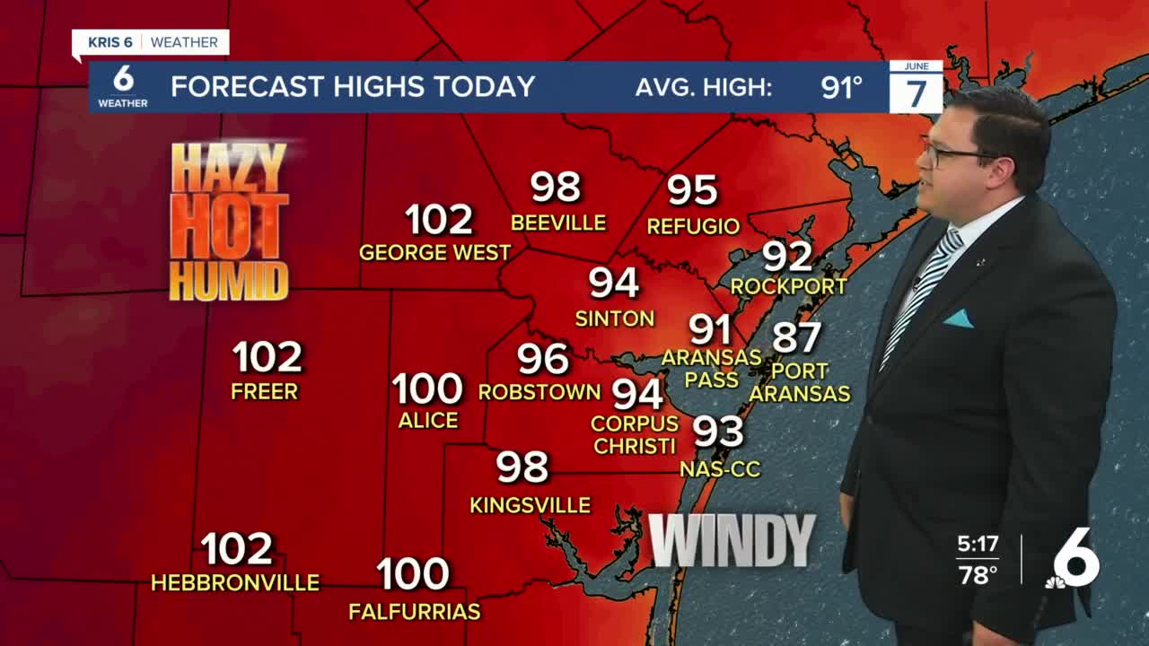
Today: Lots of sunshine, Heat Advisories inland, very hot and humid with windy conditions…High: 94…Wind: SE 15-25 MPH & gusting…Heat Index: 103-113.
Tonight: Few more clouds rolling in, plenty of humidity and warm…Low: 77…Wind: SSE 10-15 MPH.
Wednesday: Mainly sunny, little less wind, breezy and very hot…High: 95…Wind: SE 10-20 MPH…Heat Index: 103-113.
Thursday: Another round of sunshine, very hot, humid and breezy…High: 95…Wind: SE 10-20 MPH…Heat Index: 105-115.
Friday: Baking heat and dangerous heat indices, winds pick up again…High: 96…Wind: SE 15-25 MPH & gusting…Heat Index: 106-116.
Saturday: Sunny skies, breezy, humid and sweltering hot…High: 98…Wind: SE 15-20 MPH…Heat Index: 107-117.
Sunday: Sunny skies, windy, humid and still baking heat over South Texas…High: 97…Wind: SE 15-25 MPH & gusting…Heat Index: 105-115.
Have a great day and please stay cool and hydrated. Be sure to check on family and friends!
