


CORPUS CHRISTI, Texas — We start off, on this Memorial Day, with plenty of humid and warm conditions over South Texas.
We’re still holding on to a good amount of moisture pumping in off the Gulf of Mexico which is helping things stay on the muggy side.
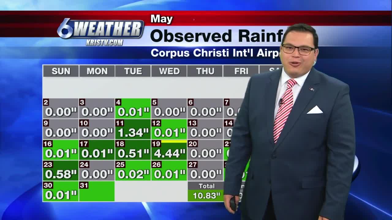
The Coastal Bend received a good amount of rainfall over the start of the weekend, with some locations picking up from 1-3 inches of rain.
Moving into this week, we’ll be watching an upper-level disturbance out to our west that will send pockets of instability almost each day into the weekend. That means we’ll be returning to a wet weather pattern.
By the end of the week, localized flash flooding may be of concern, given that our ground is already saturated, and the likelihood of rainfall accumulation amounts over the next five to seven days will be between 2-4 inches.
Best chances of rainfall, in the form of heavy rain and thunderstorms, looks to be towards Thursday, Friday and Saturday as the upper-level low nears South Texas before exiting on Sunday.
Today: Partly cloudy, warm and breezy with only stray shower…High: 87…Wind: SE 10-20 mph.
Tonight: Mainly cloudy, some spotty showers, muggy and mild…Low: 74…Wind: SE 5-10 mph.
Tuesday: Some stray to isolated showers, more clouds and still muggy and warm…High: 86…Wind: SE 10-15 mph.
Wednesday: Isolated showers increasing, manly cloudy and warm…High: 87…Wind: SE 6-12 mph.
Thursday: Scattered showers and storms, mainly cloudy and muggy…High: 85…Wind: SE 5-10 mph.
Friday: Mainly cloudy with scattered showers and storms…High: 85…Winds; SE 10-15 mph.
Weekend Outlook: Mainly cloudy with scattered to numerous showers and storms that will taper off some by Sunday afternoon.
Have a great day on this Memorial Day as we remember those who have served.
