CORPUS CHRISTI, Texas — Stubborn upper level high pressure combined with onshore flow to create dangerous heat indices throughout the Coastal Bend this afternoon, and such conditions will prevail to begin the work week. Only stray to isolated showers can be expected through the next week. A weak trough moving out of the Hill Country this evening will linger in our northern counties through Monday, and a stray shower or two is possible in those regions. By midweek, a weak disturbance in the Gulf of Mexico will bring isolated to scattered showers and thunderstorms to the coastal waters, but very little of that rainfall is expected very far inland. Highs will remain in the middle to upper 90s, with lows in the middle 70s. The tropical Atlantic Basin remains devoid of significant activity.
First 100 degree day of the year Sunday for Corpus Christi
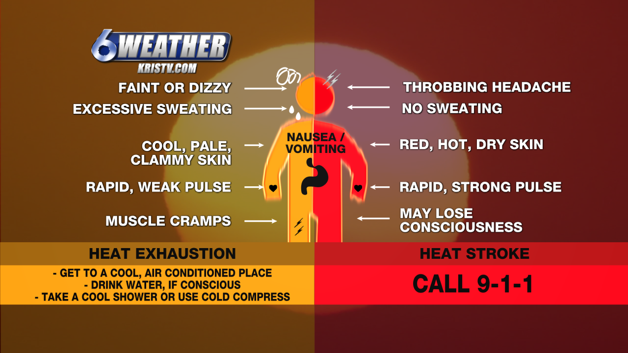
Heat Advisory remains in effect through 9 pm
6WEATHER Center
Be prepared for indices over 100 degrees this weekend.

Posted
