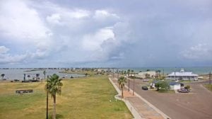
Thanks to an abundance of tropical moisture in the Gulf of Mexico moving west, we saw some scattered showers and thundershowers over the area today. Though not everyone participated, there were some decent downpours for those who saw some of the rainfall. 6WEATHER Doppler Radar estimates some location saw between half an inch up to an inch and a half of rain.
Upper-level high pressure is going to be just to our north and we’ll continue to be under its influence which will keep temperatures right around seasonal average in the low to mid-90s. However, it is just far enough north that all the moisture in the Gulf will continue to stream over towards South Texas and keep at least isolated chances of showers and thundershowers alive for the end of the week, into the weekend and early next week on Labor Day.
Tonight, showers and thundershowers will come to an end with the loss of daytime heating. Expect warm and muggy conditions with relatively light and variable winds.
We’ll call for at least isolated showers on Friday. Not a washout, in fact no one day will be a complete washout over the next several, as some residents will see little to nothing. High on Monday afternoon will heat up to 94 degrees with east-southeasterly winds around 10-15MPH.
Potential Tropical Cyclone Number 6 emerged off into the Atlantic off the coast of Africa this morning and is likely to turn into Tropical Storm Florence in the coming days. It is forecast to move west and strengthen to hurricane status by Sunday. Another area of disturbed weather near Cuba is also forecast to push west over the next couple of days and eventually move towards Florida over the weekend and bring lots of rain. Once it emerges in the eastern Gulf, environmental conditions will be conducive for some development. It certainly bears watching as we head into the peak of hurricane season. At the very least this wave could potentially bring us more scattered thundershowers early next week. We’ll be keeping a close eye on that disturbance.
Summary:
Tonight: Partly to mostly cloudy, muggy and warm…Low: 76 Winds: Light & Variable
Friday: Mostly cloudy & hot, isolated thundershowers…High: 94 Winds: ESE 10-15 MPH
Saturday: Clouds stay, hot with isolated thundershowers…High: 96 Winds: SE 10-15 MPH
Sunday: Mainly cloudy, hot and isolated thundershowers…High: 96 Winds: SSE 15-20 MPH
Monday: More clouds, isolated thundershowers, hot …High: 95 Winds: SE 15-20 MPH
Tuesday: Few more clouds, hot & muggy, scattered thundershowers… High: 92 Winds: ESE 10-15 MPH
Wednesday: Few more clouds and increased scattered thundershowers…High: 92 Winds: ESE 10-15 MPH